Personal Review
My take on this trail.
The Ride
Within five minutes of dropping in, the Lower Don Valley Trail completely rewires what you think Toronto is. You pick it up around Overlea Blvd and Don Mills, and suddenly you're inside a ravine. A real, proper, steep-walled ravine. Trees closing in overhead, and the traffic noise disappears. The sound of the river does most of the talking down here.
The trail runs south through the valley, passing under a series of concrete underpasses. Bloor Viaduct, the DVP. They're a little narrow, but there's something about rolling through these shadowy concrete corridors that makes you feel like you've found a secret passage through the city.
Around Pottery Road, the trail forks. You can continue south along either the Lower Don or Bayview Rd, toward Evergreen Brick Works. Staying on the Lower Don, the ravine opens up as you ride further south. The CN Tower starts appearing through gaps in the canopy. The city is right there, just above you. This trail is a bit different from anything else in Toronto. A quiet green corridor running through the most concrete-heavy part of the city.
The southern end connects to the waterfront near Corktown Common. The Distillery District is less than 5 minutes away to enjoy a coffee or a local beer from one of the breweries. It's a satisfying place to end a ride.

Seasonal Notes
Spring is when the trail wakes up. The edges can get muddy for the first few weeks after the snow melts, and the river runs high and loud, which is actually beautiful. Wildflowers start appearing along the banks by late April. It's the season where the ravine feels most alive. A little rough, a little untamed, and full of that new-growth smell.
Summer is prime time, but that means the trail gets busy. Weekends can feel crowded by mid-morning, especially the section near Riverdale Park. My advice: go early. The light through the canopy in the morning is gorgeous, and the air still has that cool morning edge before the humidity settles in.
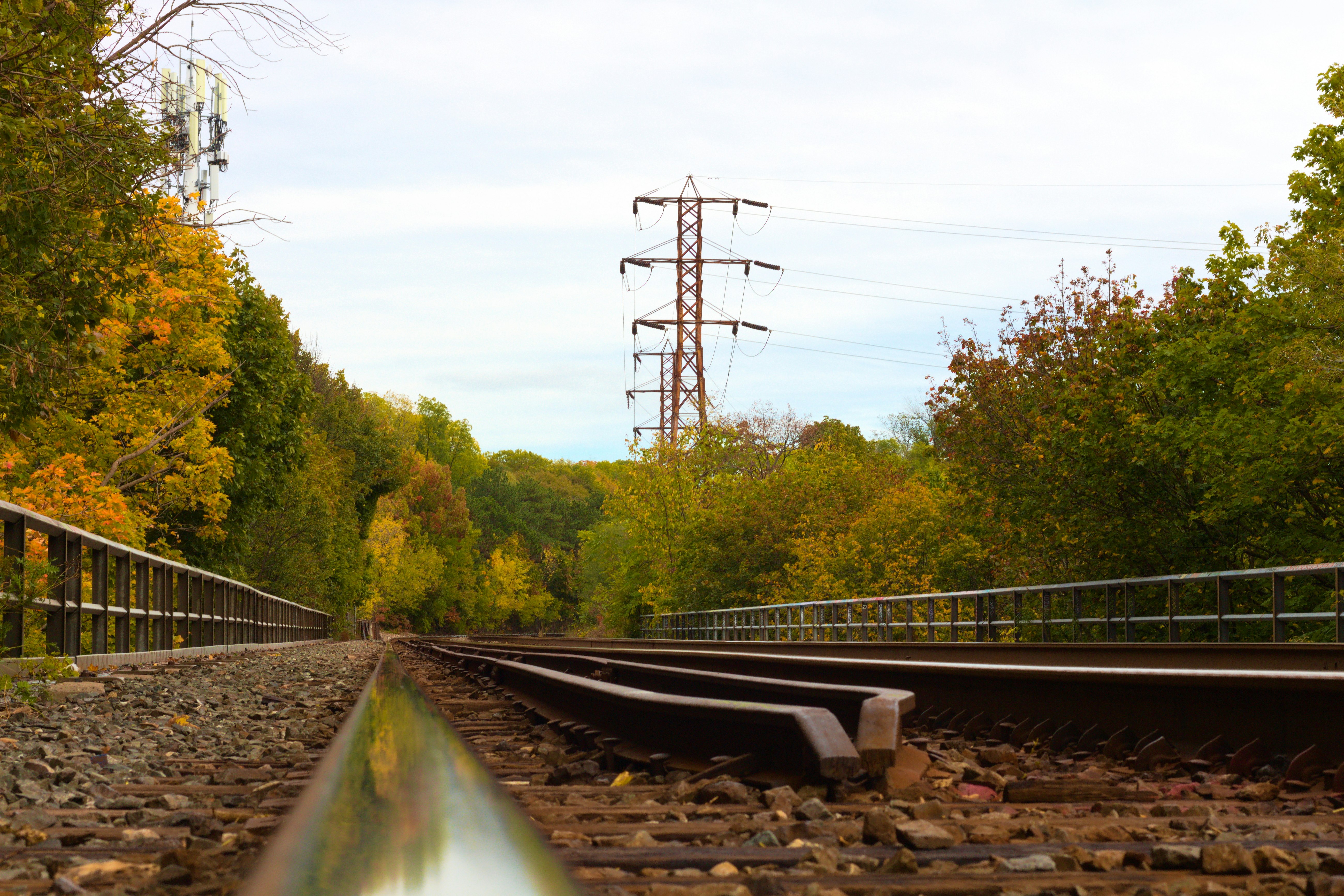
Autumn is the peak. If you ride this trail once a year, ride it in October. The maples along the ravine walls go full red and gold, and on a still morning, the fallen leaves line the path like a carpet. It's the kind of beauty that makes you ride slower on purpose.
Winter is possible but requires caution. The paved surface gets cleared reasonably well, but the sections under the underpasses can be icy, especially where meltwater pools and refreezes. Fat tires or studded tires help. Fewer people out here in winter, which has its own appeal. The bare trees open up sightlines you don't get the rest of the year.