Personal Review
My take on this ride.
Toronto to Port Credit
The first 25 km of this ride is the Port Credit Ride, which has its own page on this site. The short version: you ride west along the Toronto waterfront, through Humber Bay, Mimico, Etobicoke, into Mississauga and eventually reaching the Port Credit Lighthouse. It's a great ride on its own. If you're riding to Oakville, Port Credit is where the first chapter ends and the second begins.
Port Credit to Oakville
Past Port Credit, you turn into J.C. Saddington Park. It's a beautiful waterfront park. View the skyline in both directions: Toronto's behind you on the left, Hamilton's ahead on the right. The path hugs the water here, and the ride here is awesome. You transition back to residential streets for a stretch, passing through the Brueckner Rhododendron Gardens, before hitting Lakeshore Road. This section has hills, but what goes up, must come down.
At Jack Darling Memorial Park, you descend about 600 metres down to the waterfront and the beach cruise begins. This park is always alive. Families at the beach, barbecues going, hot dog vendors in season. The willow trees by the water are beautiful. It's a good place to stop, eat something, and let the legs recover.
At the end of Jack Darling, you have a choice. The main route takes you through a residential neighbourhood and back to Lakeshore Road. The optional detour is Rattray Marsh Conservation Area. Cycling is prohibited through the marsh, so you'd have to walk, but it's a scenic natural area and worth checking out at least once.
Either way, you end up back on Lakeshore Road for the final stretch. You pass through Lakeside Park for more lake views, then grind out about 5 km of straight road shared with cars. After 37 km of riding, this section takes discipline. The drivers along here are used to cyclists and generally give space when passing, but have your lights on.
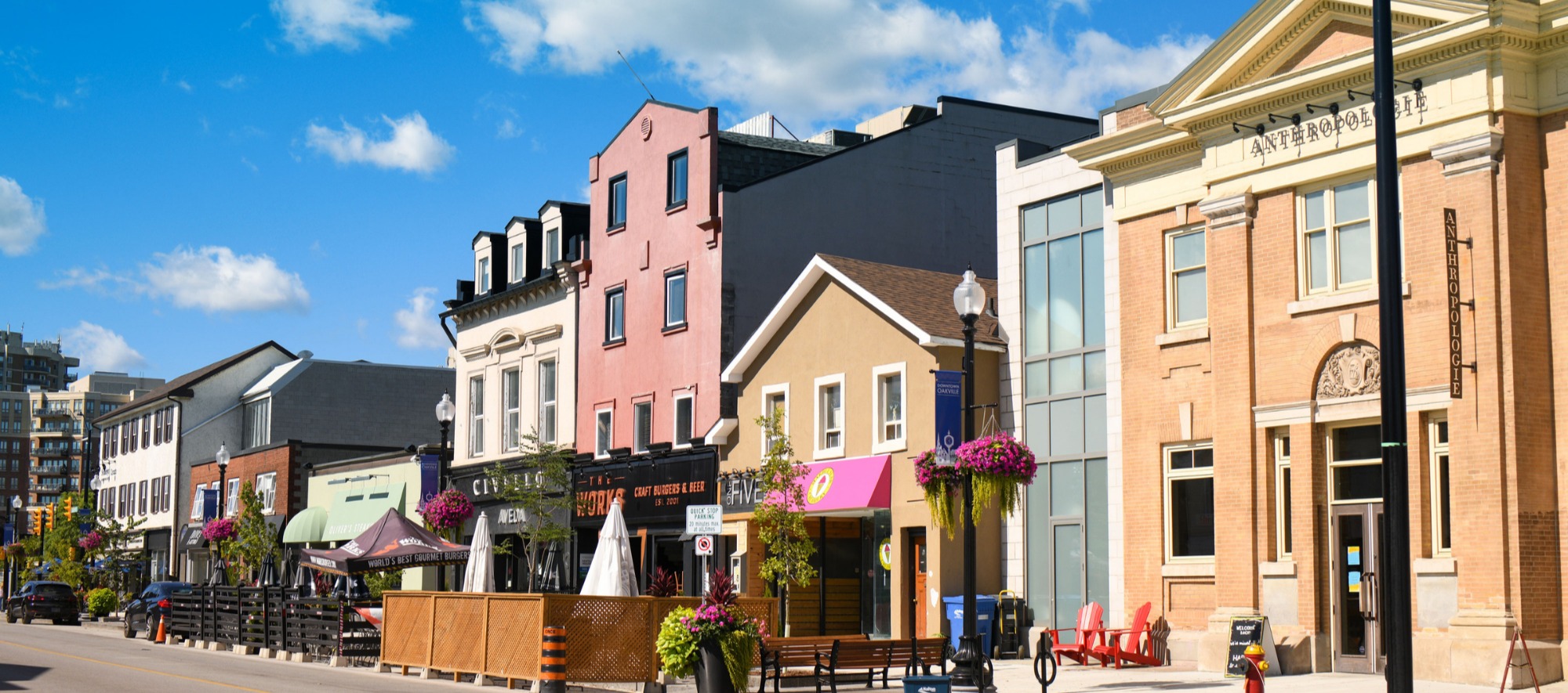
After the final 5 km stretch, you're suddenly in a small downtown with a calm atmosphere. It feels like a small town, even though it's technically part of the GTA sprawl. Local cafes, restaurants, ice cream shops, a place that does cinnamon rolls. It's more relaxing than you'd expect from a place called "downtown."
From here, you can take the GO Train back to Toronto, or you can keep going. The waterfront trail continues west to Bronte and then Burlington. Oakville doesn't have to be the end. But after 42 kilometres, it's a good place to sit down, eat something, and decide.
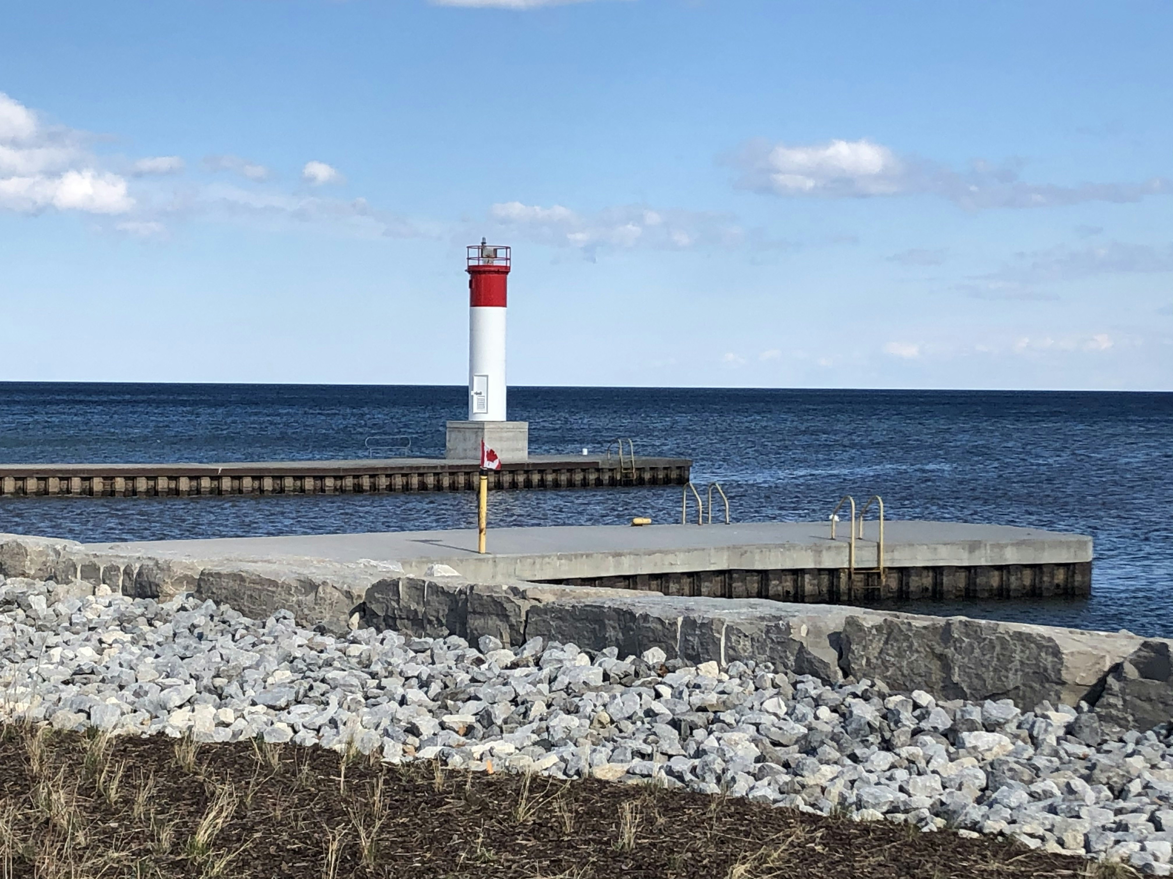
Detour to the Oakville Lighthouse
As you approach downtown Oakville, there's an optional detour off Allan Street onto a narrow trail right alongside the water. This path takes you to Lakeside Park, a green space with animal statues, rocky shores, and the Oakville Lighthouse. Tannery Park is nearby on the other side of the river with more lake views on a smooth path. Both are worth the short detour.
Worth Knowing
The marsh they almost paved over
Rattray Marsh, the conservation area you pass near Jack Darling Park, is the last remaining lakefront marsh between Toronto and Burlington. Ninety-four acres of wetland, old-growth Carolinian forest, and cobble beach sitting right on the shore of Lake Ontario.
It almost didn't survive. When Major James Rattray died in 1969, developers moved to build luxury homes and a yacht marina on the property. The marsh would have been dredged and filled in. A group of local residents formed the Rattray Estate Preservation Committee and spent 16 years fighting to save it. They raised funds through the Nature Conservancy of Canada, lobbied the township council, and organized opposition at every public hearing. In 1975, Credit Valley Conservation officially opened it as a conservation area.
Today the marsh is home to 428 plant species and 227 bird species. Herons, beavers, deer, and foxes live here. It's designated as an Environmentally Significant Area, a Provincially Significant Wetland, and an Area of Natural and Scientific Interest. Over 300,000 people visit each year. You can't cycle through it, but you can walk the boardwalk trails and see the marsh up close.