Personal Review
My take on this trail.
The Ride
The Humber River Trail is 25 kilometres of following a river from the northern edge of Toronto to the lake. The terrain is flat enough that the distance is the only real challenge. Ride it north to south and the route works in your favour, a gentle net downhill that lets you settle into a pace and stay there.
The northern sections are the wildest. The path winds through tight corridors of trees with the river close beside you, and the city feels far away. The trail curves constantly, bending with the river, so you're never riding a long straight stretch. Every turn opens a slightly different view. Forest gives way to meadow, tall grass and wildflowers lining the path, then the trees close in again.
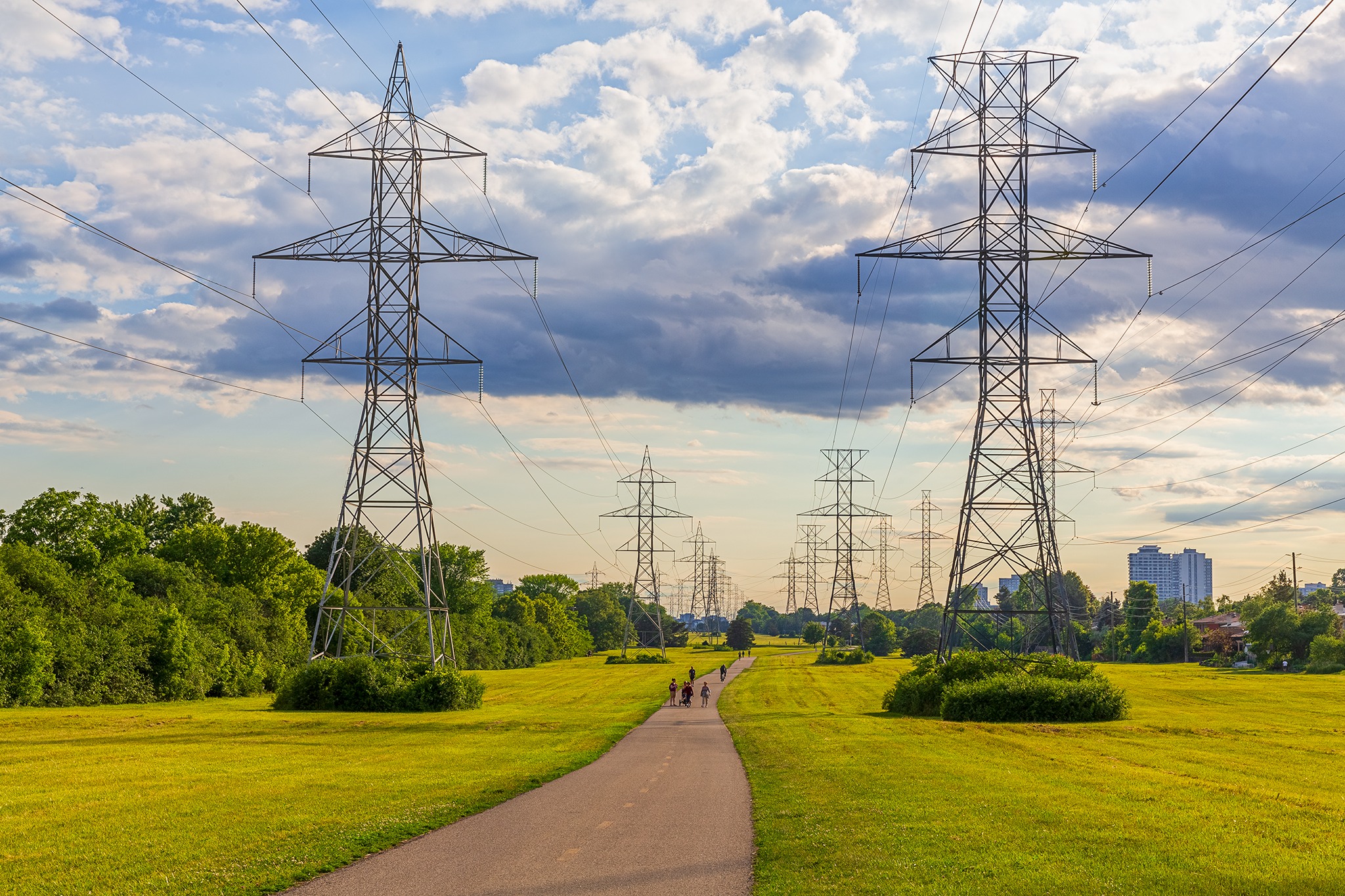
As you ride through the trail, pockets of open parkland appear and disappear. Wide green spaces with the river still threading through the middle. The corridors of trees return between the parks, so the ride keeps alternating between enclosed and open, between canopy and sky. The river is your constant. You lose sight of it briefly, and then it's back, moving slower as you get closer to the lake.
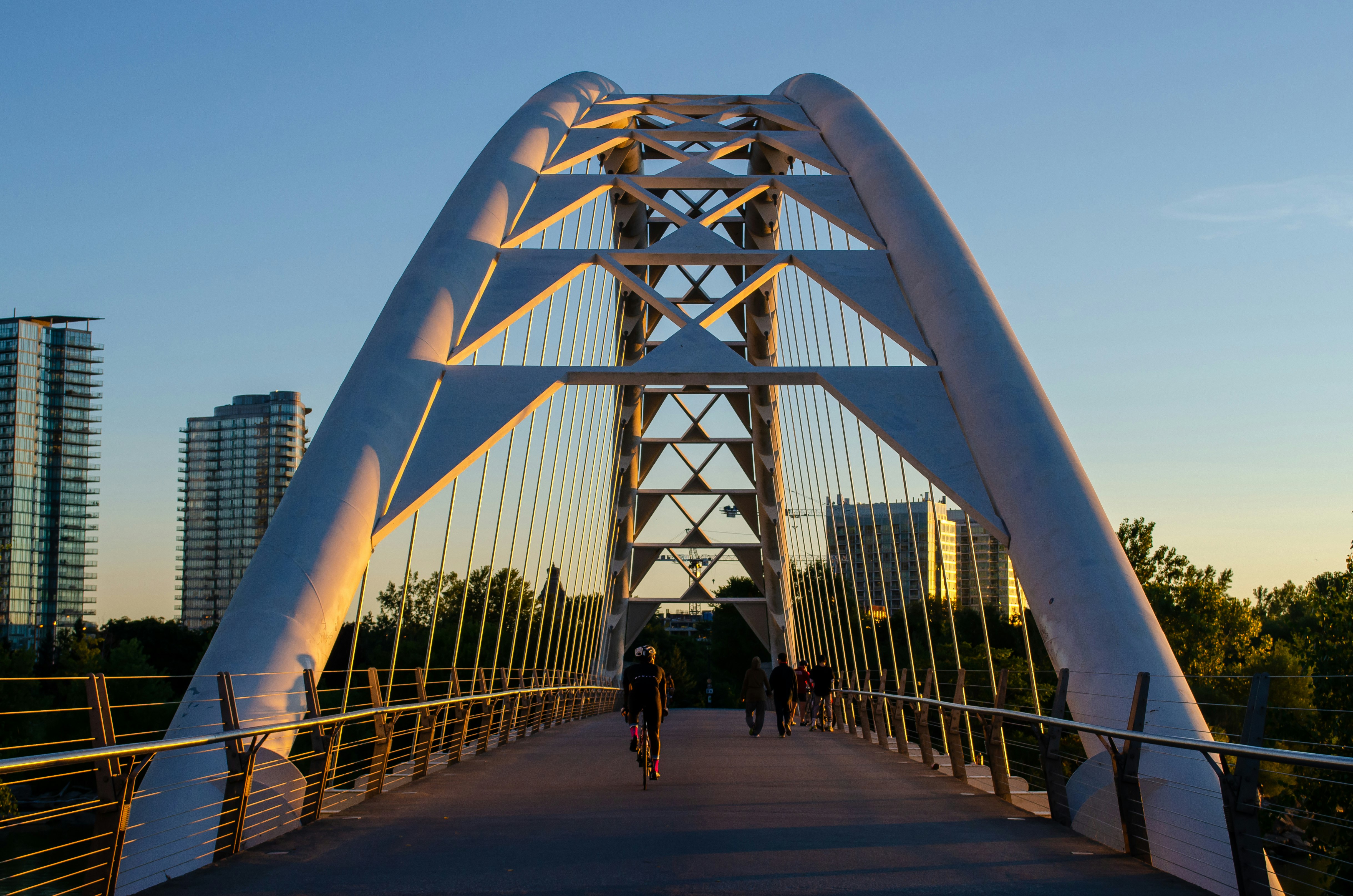
The final stretch opens up completely. The trail reaches the waterfront, the Humber Bay Arch Bridge appears, and Lake Ontario spreads out in front of you. From here you can connect west onto the waterfront trail or east onto the Martin Goodman Trail back toward downtown. It's a satisfying ending. Twenty-five kilometres of river and forest, and then the lake.
The Views
The Humber River Trail has more visual variety than most trails on this site. Here are the ones that stand out.
Emmett Waterfall is an impressive stacked cascade early in the ride. The river drops over a series of wide steps, and on a summer day you can hear it before you see it. It's a good spot to stop and take a photo.
Further south, the trail crosses a wooden boardwalk bridge with views of the Lambton Canadian Pacific Railway Bridge towering above. The scale of the railway bridge is striking from below. You're riding across a small wooden bridge over the wide Humber river, looking up at this massive concrete arch. It's one of the more unexpected visual moments on the trail and there's benches to take a break.
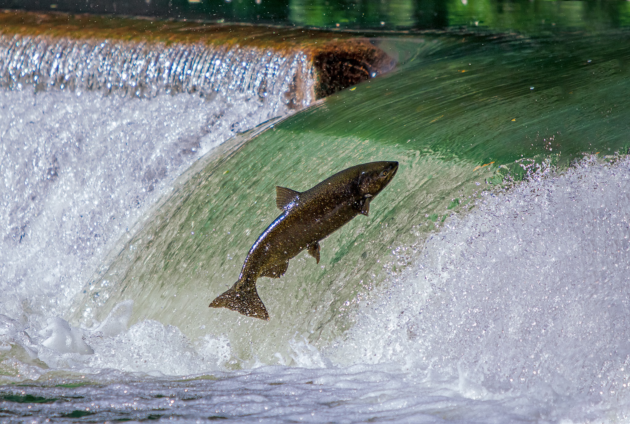
The Trout and Salmon Ladder is a cascading waterfall where, in the right season, you can watch fish leap upstream. Salmon run here from September through November, with the peak in early to mid October. Fewer people know that trout also run in late March and April. Stand on the bridge and watch. It's one of those things that makes you realize the river is doing more than just flowing past.
The Old Mill Bridge is a historic stone arch bridge where the Humber River runs wide and calm. It's a quiet spot near the Old Mill neighbourhood, and worth a pause. The final landmark is the Humber Bay Arch Bridge at the southern tip, a modern white arch over the mouth of the river where it meets the lake. It's become one of Toronto's most photographed bridges, and it's a fitting way to end 25 kilometres of riding.
Worth Knowing
The river that was here before the city
The Humber River was designated as a Canadian Heritage River in 1999, one of a few urban rivers in the country to receive that recognition. For thousands of years before Toronto existed, the Humber was a major travel and trade route for Indigenous peoples. The river connected Lake Ontario to the upper Great Lakes via a portage to the Holland River, making it one of the most important corridors in the region. The French called it the Toronto Carrying Place.
Today, the river is also home to one of Toronto's most remarkable wildlife events. Every autumn, Chinook salmon migrate up the Humber from Lake Ontario to spawn. From September through November, you can stand at the fish ladder and watch them fight their way upstream, jumping up the waterfall one at a time. The peak is usually early to mid October, and it draws crowds of onlookers who line the banks. It's a powerful thing to watch. These fish have come from the open lake, navigated the mouth of the river, and are now climbing a waterfall inside a city of three million people.
What fewer people know is that trout make a similar run in the spring. Late March through April, if you're watching the same waterfall, you'll see them. The spring run is quieter, smaller, and less well-known. But it's there. The river is alive in both directions, in both seasons.