Personal Review
My take on this trail.
The Ride
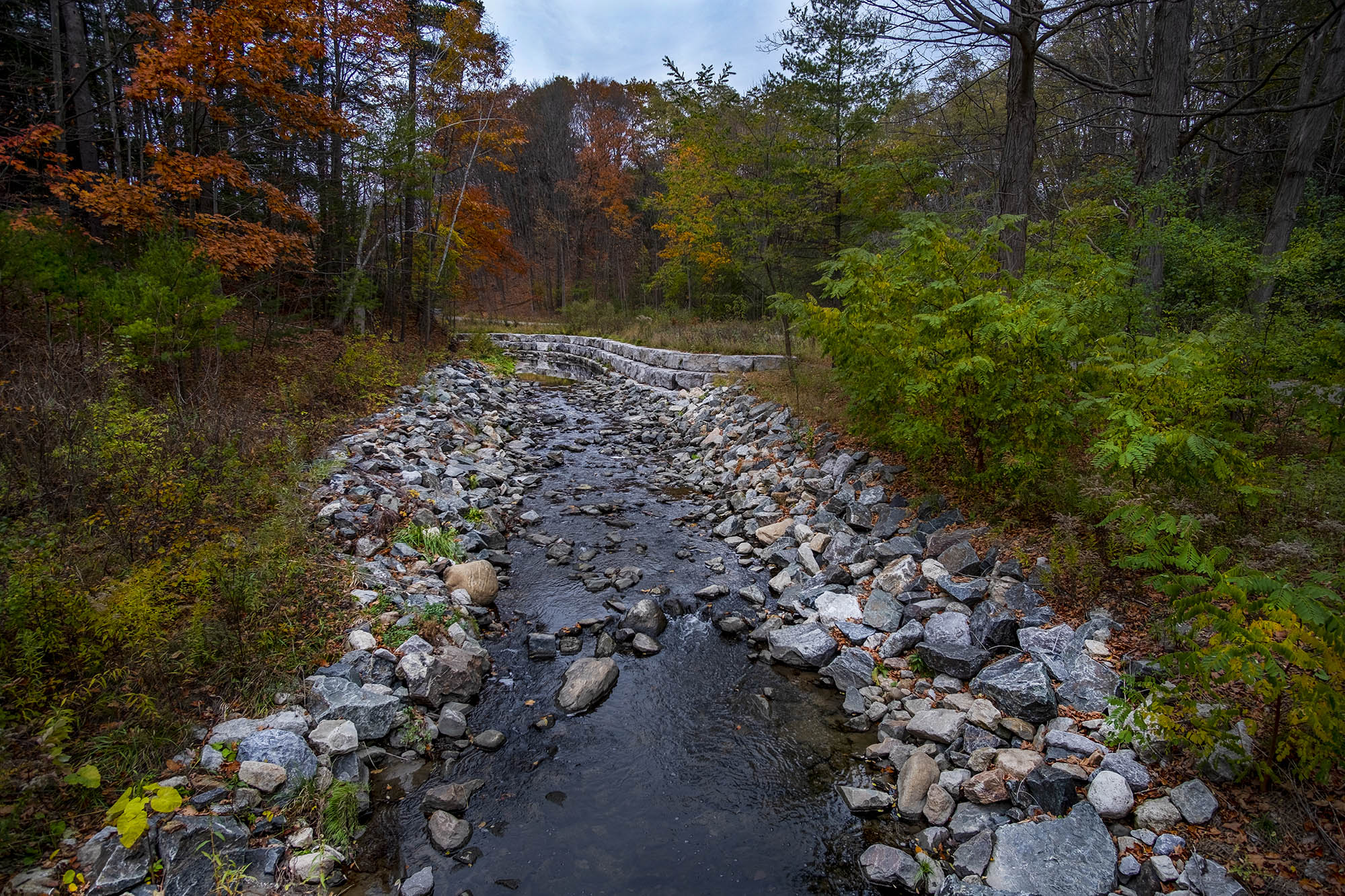
Here's what surprised me about Wilket Creek: it's surprisingly big. Not in distance – at 3 kilometres, you can ride it end-to-end in 15 minutes if you're moving with any purpose. The surprise is in atmosphere. The ravine feels open and vast in a way that's completely disproportionate to its actual size, and by the time you're a few hundred metres in, you feel like you've gotten away from the city even though you haven't. Leslie Street is right there on the other side of the trees. You just can't tell.
The valley walls are high enough to block out the surrounding neighbourhood entirely. The canopy overhead. The creek runs alongside the path, quiet and steady. And the whole space opens up around you in a way that makes 3 kilometres feel like a much longer journey than it is. I've ridden trails twice this length that felt half this size. The height of the walls, the width of the valley floor, the depth of the forest on the slopes all create a sense of scale that the distance alone doesn't explain.
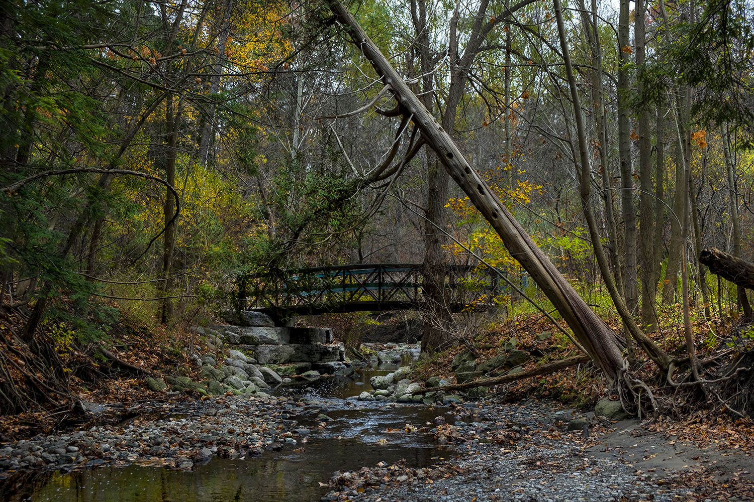
The main corridor is smooth and easy. Wide, paved and well-maintained, it's appropriate for any level of rider. But the trail doesn't exist in isolation. Side trails and dirt paths shoot off the main route in multiple directions, disappearing into the trees. This is where part of Toronto's mountain bike network begins, and as you ride the main path you'll catch glimpses of riders threading through the forest above. You're not just on one trail, you're in a space that contains many trails, and at any point you could leave the main path and find something completely different.
At the northern end is Edwards Gardens, one of Toronto's most formally beautiful parks, a pleasant contrast to the wild ravine you've just been riding through. At the southern end, Sunnybrook Park, open and wide, a different kind of green. Both are worth the visit. The trail is the link between them, and it's a good link. Better than it has to be for 3 kilometres.
The Endpoints Are Worth the Ride Alone
Edwards Gardens, at the northern end, is one of Toronto's most beautifully maintained public gardens. Formal flower beds, rock gardens, a creek running through manicured grounds. After the wild ravine of Wilket Creek, arriving at Edwards Gardens is a fun transition: forest to garden, natural to cultivated, the unplanned beauty of the ravine giving way to something deliberate and precise. The gardens are free and open daily. The seasonal café is worth a stop. Sit outside, look out over the flower beds, let the ride settle.
Sunnybrook Park at the southern end is a different kind of endpoint entirely. Where Edwards Gardens is precise, Sunnybrook is sprawling – vast lawns, the West Don River, equestrian facilities, playing fields, the kind of open parkland that lets you see the sky again. There's more mountain biking trails here as well, if you have the appropriate bike.
Worth Knowing
The Leaside Spur Trail: same journey, different experience
Here's something some people might not know: the Leaside Spur Trail runs parallel to Wilket Creek on the other side of Leslie Street. Both trails connect the same two endpoints: Edwards Gardens in the north, Sunnybrook Park in the south. But they couldn't be more different in character. The Leaside Spur is more straightforward – narrower, less exposed, but a faster ride. Wilket Creek is the scenic route. Forested, enclosed, wilder, slower by nature.
What this means practically: if you're riding with someone who wants to cover distance efficiently, send them down the Leaside Spur. If you want to disappear into the ravine, take Wilket Creek.